Precision Ag & Wildlife Services LLC
La Grange, Texas
Now booking
Need a deer survey for your MLDP property or your wildlife ag exemption? We’re booking whitetail deer surveys now in Fayette County and the surrounding counties. Thermal deer surveys are the first thing Precision Ag & Wildlife Services puts in the air. We fly your place after dark, count what the camera picks up, correct for what thermal is known to miss, and hand you a written report you can put in front of your biologist. Quiet on the deer, and nobody has to sit a spotlight route. Tracts of 1,000 acres and under are welcome — the places aerial survey has always priced out.
Fully licensed with TPWD, fully insured, and the calendar is open. Surveys are booking now for this season.
New this season
1,000 ac & under Now on the flight calendar
If you're in the Conservation Option side of the Managed Lands Deer Program, Texas Parks & Wildlife asks you to put deer population data in front of your biologist when you enroll and again every year after. Getting that data has always been the hard part on a smaller place. A helicopter has to justify the trip, so the outfits flying them want acreage — and a spotlight route down whatever road you happen to have is a thin way to count a herd.
A drone doesn't have to justify a ferry flight. It comes in the back of a truck, launches off your caliche, and flies a planned grid across whatever you've got. That changes the arithmetic on small tracts, which is why we can now put places of 1,000 acres and under on the survey calendar alongside the big ones — same aircraft, same method, same written report at the end.
To be straight about it: what you get from us is a survey report built to go in front of a biologist — how the flight was flown, what was seen, what was corrected, and why. We don't speak for Texas Parks & Wildlife, and we won't tell you a survey checks a box on your enrollment. Whether the data suits what your biologist needs is between you and them. Ask them first; we'd rather you did.
Why thermal
A spotlight count sees what's standing in the open, looking your way, on the road you happen to drive. A helicopter sees more and costs a great deal more, and every animal on the place knows it came. A thermal camera flown at 150 feet doesn't care about color, cover, or which way an animal is facing — it reads body heat against cool ground, which after dark in the fall is about as plain a signal as you'll find in this country.
The drone flies a planned grid, not a route of convenience, so the same acres get covered the same way this year and next. That repeatability is worth more than any single night's number: it's what lets you tell whether your fawn crop actually moved or whether you just had a better night.
Getting one booked
Step one
Call, text, or email. What we need to start is your county, the rough acreage you want flown, and how you've been counting up to now. If the place is small, say so — that's no longer a problem. You'll get a straight price for your acreage on that first call, not a range built to sound low.
Step two
Thermal wants a cool, clear, low-wind night, and the count means the most late in the year once the rut settles and the fawn crop can be judged. We pick a target night together and set a backup behind it, because weather gets a vote. Book early in the season and you get first pick of the good nights.
Step three
Texas requires a Landowner Authorization — an LOA — before anyone manages or surveys wildlife from an aircraft over your place. You or your agent sign it, we sign it, and it goes to Texas Parks & Wildlife with your property location and a georeferenced map. The department has to approve it before we can fly, and the approved authorization rides in the aircraft with the pilot. We fill out our side and walk you through yours — just start it early, because the approval takes what it takes.
Step four
We show up at dark and fly the grid. You're welcome to stand at the truck and watch the screen, or go on to bed and read about it — either way the footage gets reviewed afterward, not just totaled in the field, and the written report follows.
On the night
Step one
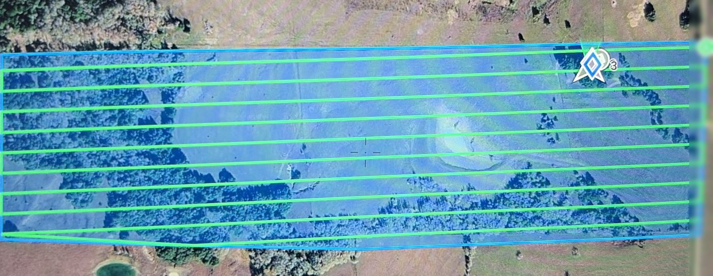
You tell us the tract and the acreage; we build a grid of parallel flight lines across it with about 20% overlap between passes, so nothing falls in a seam. You see the plan before we fly it.
Step two
The aircraft is a DJI Matrice 4T with a thermal camera. It works the lines at about 12 meters a second, 150 feet up — high enough that deer go on about their business, low enough that the camera resolves them cleanly. A tract runs anywhere from a few minutes to a couple of hours depending on size.
Step three
Every heat signature gets looked at and called — doe, buck, fawn, hog, or something else. Raw thermal counts always come in under the truth, so a correction factor is applied to the deer numbers to account for animals bedded, screened by canopy, or sitting at the edge of the swath.
Step four
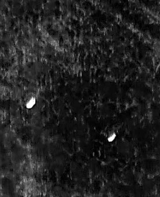
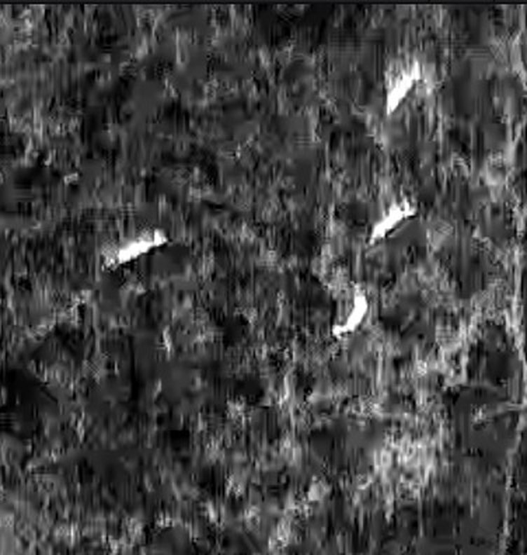
Flight conditions, the flight map, observed and corrected counts by species and class, fawn-per-doe ratio, density per acre, and sample thermal captures — written up so it stands on its own when somebody else reads it.
What you get
Here's the shape of it. The figures below are a made-up example so you can see the format — your report carries your ranch, your night, and your numbers.
Sample — illustrative figures only
Thermal aerial wildlife count · example 320-acre tract, Fayette County
| Species | Category | Observed | Corrected |
|---|---|---|---|
| Whitetail deer | Does | 14 | 18 |
| Whitetail deer | Bucks | 6 | 8 |
| Whitetail deer | Fawns | 9 | 12 |
| Feral hog | — | 11 | 11 |
A correction is applied to the deer counts to account for animals thermal typically misses — bedded deer, poor thermal contrast, and animals near the edge of the flight swath. Non-deer species are reported exactly as observed: the correction factor is calibrated for deer and hasn't been validated on anything else, so we don't pretend it has been.
Corrected totals for this example: 38 deer · fawn-per-doe ratio 0.67 · buck-to-doe about 1:2.3 · roughly 8.4 acres per deer on the surveyed tract.
Straight talk
It is not a census. Thermal sees more of a property than a spotlight route or a helicopter pass ever will, but heat signatures still get screened by canopy, brush, terrain, and distance from the flight line, and some judgment remains even after a second look at the footage. The corrected numbers account for that known undercount. They're a defensible estimate — not a claim that every animal on your place was seen.
It is also not a substitute for your wildlife biologist. The report is built to be handed to one: it says how the flight was flown, what was seen, what was corrected, and why. What your harvest ought to be is their call and yours, not the drone's.
And it won't work every night. Warm evenings, heavy fog, and high wind all hurt a thermal pass. If the conditions aren't right we'll move the flight rather than hand you a number we don't believe.
Timing
Pricing is set by acreage. Call and ask — you'll get a straight number for your place, not a range designed to sound low.
Get on the calendar
County, rough acreage, and how you've been counting up to now is all we need to start — and a small place is a fine place to start. No obligation and no deposit to ask, and we won't fill up your inbox.
We'll come back with a date and a straight price for your acreage. Nothing else — no newsletter, no list swapping.